LiDAR Data Access
The Department of Natural Resources and Mines, Manufacturing and Regional and Rural Development has an ongoing LiDAR capture program. Data is made available for purchase, and data out of licence is made available for free to download.
LiDAR > 3 years old is available for free download in ELVIS Portal
LiDAR < 3 years old needs to be purchased - see Digital topographic data >Data and products for prices.
| LiDAR Type | Format | Links |
|---|---|---|
| Point Cloud | LAS file - AHD | Free in ELVIS |
| LAS file - Ellipsoid | Purchase Imagery and LiDAR form | |
| Derived Products | ||
| DEM (Digital Elevation Model) | tiff | Free in ELVIS |
| DEM SRTM-derived 1 second | Web services - WCS & WMS | Free in ELVIS |
| DEM 5m derived from LiDAR | tiff | Free in ELVIS |
| DTM (Digital Terrain Model) | COG Geotif | Free in ELVIS |
| (Ascii format) xyz | Purchase Imagery and LiDAR form | |
| (Ascii format) zgrid | Purchase Imagery and LiDAR form | |
| DSM (Digital Surface Model) | COG Geotif, ngrid | Purchase Imagery and LiDAR form |
| DSM SRTM-derived 1 second | tiff | Free in ELVIS |
| DHM (Digital Height Model) | cog | Purchase Imagery and LiDAR form |
| CHM (Canopy Height Model) | Purchase Imagery and LiDAR form | |
| Contour Data | ||
| 25cm Contours | shp format | Purchase Imagery and LiDAR form |
| 1m (more than 3 years old), 5m, 25m contours | shp, tab, kmz, and gdb | Download from QSpatial |
| Bathymetry | Free in ELVIS |
Free LiDAR Data - Older than 3 Years
Free LiDAR as a Service
Data older than 3 years can be accessed for free through the ELVIS Portal (Geoscience Australia). Follow these steps:
- Digital elevation models (DEM) elevation heights (PDF, 3.1MB)
- LiDAR capture project extents (LiDAR) projects (PDF, 2.4MB)
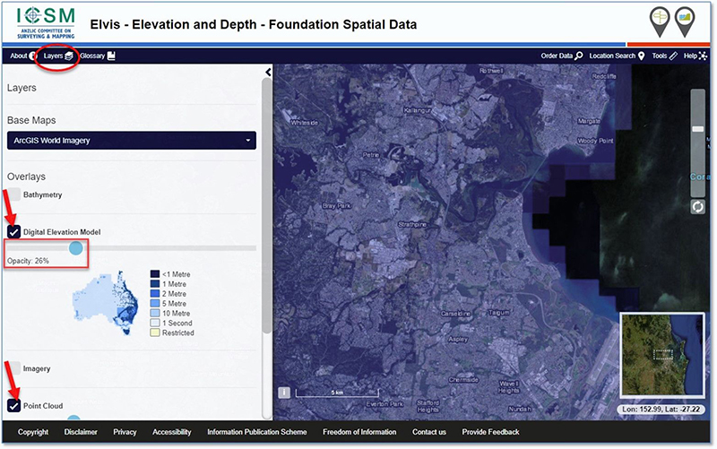
- View DEM and Point Cloud Data:
- Click the Layers button in the top menu and check the boxes for DEM and Point Cloud data.
- Adjust the opacity of the layers to view the base imagery in the keymap.
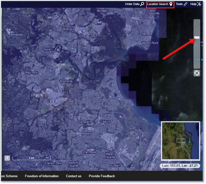
- Zoom to Area of Interest:
- Zoom to your area of interest or use the ‘Location Search’.
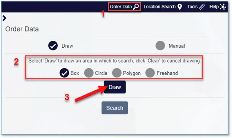
- Discover and Order Data:
- Click ‘Order Data’.
- Select a draw toolwand click the ‘Draw’ button
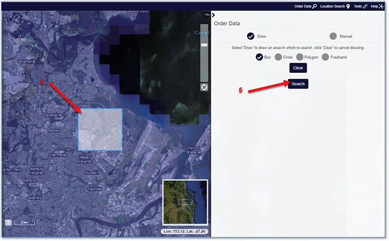
- Draw the area in the keymap and click ‘Search’
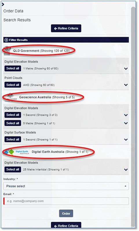
- Expand the search results to refine the data area in the keymap
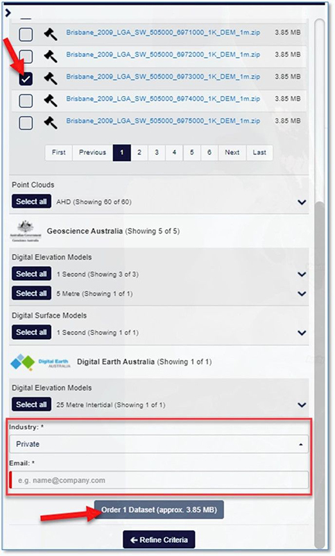
- Check the box to select each data file, select your industry, and enter your email address
- Click ‘Order X Dataset’. You will receive an email with the selected datasets
Free LiDAR as a Web Service
LiDAR data older than 3 years can be consumed as a web service using a GIS application. The following services are available:
- 0.5 or 1 Metre LiDAR DEM
- 1 Second (30 Metre Resolution) Hydrologically Corrected SRTM Digital DEM
- 30, 100, 250 Metre Resolution Bathymetric Data
- Queensland DEM: Time Series
- Imagery Layer: Elevation/DEM_TimeSeries_AllUsers (ImageServer)
- WMS: Elevation/DEM_TimeSeries_AllUsers ImageServer WMSServer
- Queensland DEM: Latest Cache
- Imagery Layer: Elevation/QldDem (ImageServer)
- WMS: Elevation/QldDem ImageServer WMSServer
LiDAR data extents in Queensland Globe
Queensland Globe allows you to visualise and identify the available LiDAR data extent, but no actual LiDAR data will be downloaded from this platform.
To find recent LiDAR data (less than 3 years old) using the Qld Globe:
-
Add the Elevation project extents layers:
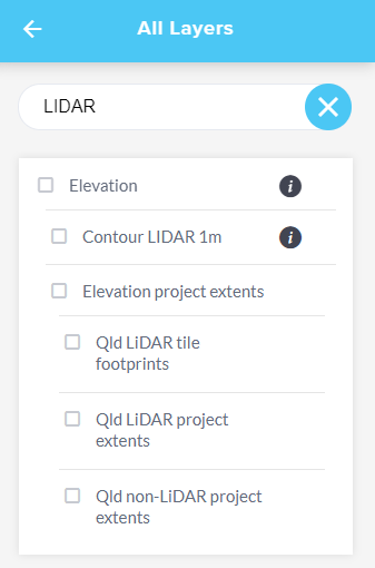
- Once Queensland Globe is open, click on the Layers panel and click "Add layers".
- In the search bar at the top of the Layers panel, type "LiDAR" or "Elevation".
- Look for the Qld LIDAR tile footprints or Elevation layer under the search results. Click on it to add it to your map.
-
Zoom to Your Area of Interest:
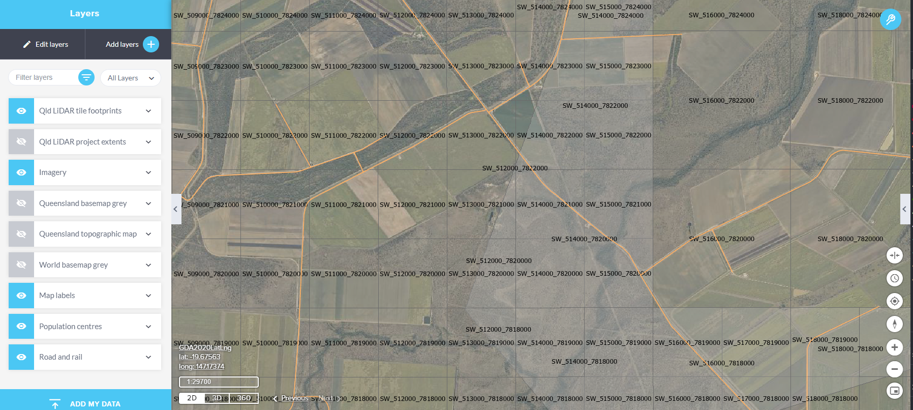
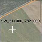
- Ensure the map is zoomed in to your specific area of interest. The tile footprints will display at a scale of 1:18,056.
-
Open the Tools Menu:
- Click the spanner icon located at the top right corner of the keymap.
- Choose the "Identify tool" from the options in the Tools menu.

-
Identify the Area of Interest:
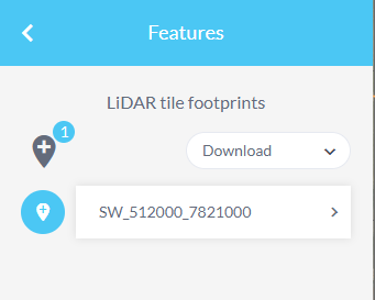
- Click on the area of interest on the map. The LiDAR tile footprints layer will display on the left side of the keymap.
- Click on the identified LIDAR tile footprints layer to display the tile number.

Hillshade
A hillshade is a visual representation that simulates the effect of sunlight shining on the terrain, creating shadows and highlights to give the surface a three-dimensional appearance. Hillshades are generated from elevation data (usually from a DTM) by calculating how light would hit the surface at a specific sun angle. The result helps in visualising terrain features like slopes, valleys, and ridges more clearly.
Both the traditional and multidirectional hillshade layers in Queensland Globe are generated on-the-fly and derived from a Digital Terrain Model (DTM) using various sources, including LiDAR, Ortho DEM, and SRTM.
The Hillshade layers are not available as imagery raster files and not available for download.
 Hillshade traditional
 Hillshade multidirectional
Cadastral boundaries
The spatial location of cadastral boundaries shown vary in positional accuracy. The information shown in this application should not be used for any of the following purposes:
- Boundary dimensions
- The existence or otherwise of encroachments
- Boundary locations on site
- Locations of improvements on site, or
- Locations of physical feature boundaries such as creeks for rivers
The true location of cadastral boundaries is not determined using coordinates or imagery and can only be determined by a Registered Cadastral Surveyor who will measure the physical evidence on the ground and reinstate the boundary.